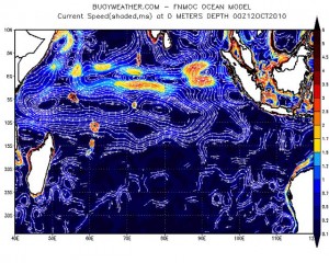
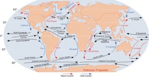
There will be many decisions to be made over the coming months, but possibly the most important one is exactly when and from where I depart to row across the Indian Ocean. I am extremely grateful to Sarah Outen for most kindly checking out the territory in advance.

In particular, Sarah discovered the hard way just how tough an adversary the Leeuwin Current can be. A strong, south-flowing current that parallels the coast of Western Australia, it swept Sarah too far south. She ended up doing what she calls her “warm-up lap”, an 11-day loop from Fremantle back to Fremantle.
Warmups are all very well, but I will be at sea for around 5 months as it is, taking the significantly longer route northwest to Mumbai in India, so I’d really just as soon skip the warmup and get on with the real thing.

It looks as if my best strategy will be to hug the coast as I head north towards Geraldton, then peel away and out into the Indian Ocean. I’ll just need to make sure that my hug doesn’t become TOO intimate and I end up shipwrecked. This had better be one of those kind of arms-length kind of hugs at a safe distance of several miles, rather than a hello-you’re-my-best-friend-ever kind of a hug. According to my weatherman, Lee Bruce, “It looks like the shoaling is good 20nm wide at the narrowest point, so you should be able to work within that 20nm corridor.”

The good news is that then the winds should in theory be really helpful, whizzing me northwest and India-wards. Look at all those lovely wind arrows. Having had to crab my way across the Pacific Ocean for the last 3 years, always trying to push south, it would be exhilarating to point my bows straight downwind for a change.
Other Stuff:
I’ve just finished reading a couple of contrasting ocean rowing books – both darned good reads:
A Little Goes A Long Way: James “Tiny” Little’s blog from his mid-Atlantic crossing, told in Tiny’s inimitable, understated style.
A Pearl In A Storm: Tori Murden was the first woman to row solo across an ocean. Favourite line: “Let’s face it: normal, well-adjusted women don’t row alone across oceans.”
Unlike me, Tori looks like a proper ocean rower – six foot tall and most definitely a tough lady. This is why I make sure to correct anyone who mistakenly introduces me as the first solo woman to row the Atlantic. I would not want to get on the wrong side of her.
On her first attempt, in the North Atlantic, her boat capsized 15 or 16 times in 72 hours during Hurricane Danielle. She sustained extensive injuries, and eventually pressed the emergency button on her EPIRB beacon to request rescue. To her great credit, she went back for more, and successfully crossed the Atlantic by the equatorial route.
The book was an impressive reminder of just how different a creature the North Atlantic is from the mid-Atlantic. Rougher, colder, stormier, altogether more dangerous.
LAST FEW DAYS OF VOTING!
By the way, just 5 days left to vote for your “People’s Choice” National Geographic Adventurer of the Year. You can vote once in any 24 hour period at the National Geographic website. Preferably for me, please!


Roz, this blog has done it: I am now officially starting to get butterflies in my belly. I really do appreciate all that you share with us, start to finish. I learn something new from you every day. Riding with you in this front-row seat is at times spine-tingling thrilling punctuated by heart stopping suspense, not to mention lots of fun and laughs and inspiration, if not perspiration.
Yes, indeed, please save your hello-you’re-my-best-friend-ever kind of a hugs for us Rozlings. You have inspired me so please indulge! For a hug in Autumn, I’ve got a haiku for you today.
Hug the coast of Oz
Close but not too intimate
No rockin the boat
Voting daily … http://bit.ly/NatGeoVote4Roz
and also more quickly at http://bit.ly/Vote4Roz
UncaDoug
James Castrission and Justin Jones also did a loop in mid Tasman after fast progress out from Australia towards NZ a couple of years back. It took about 2 weeks (from memory) to work out that they were caught in a huge whirlpool, so they waited for the right place to paddle straight away from the centre, south of the centre and head south to escape, so they could end up out of it way south-east, and then carry on east. http://www.crossingtheditch.com.au
PS. Is it better to leave from Geraldton?
David, the road trip from Perth to Geraldton is one of the most boring you could imagine – it would be much more exciting to hug the coast line.
Fascinating graphics, Roz, you certainly put a lot of great detail in your blog.
Just realised how important spellin is. There’s “Freemantle” and then there’s “Fremantle”!
Roz; it looks like you’ll need all your accumulated experience for this one. Thankfully you now have a really excellent support team. Our prayers are with you.
Nice one, Doug!
I’ve just heard from my contact at CSIRO that the Leeuwin Current is untypically strong this year. Just great.
If you look at that map of the current, the colour red shows the warmer waters flowing south from the tropics. Well, at the moment the latest map shows the red going all the way up to the coast. See http://www.marine.csiro.au/remotesensing/oceancurrents/Perth/2011011018.html
So I’m hoping it slackens off before March 31….
Roz, I think the Brits have an expletive that might well describe that bloody red southbound current http://bit.ly/hN7hp5. I’ve got my fingers crossed that Leeuwin finds its way elsewhere soon!
Latest news from my CSIRO contact:
“We’ve fixed our current mapping system now, so http://www.marine.csiro.au/remotesensing/oceancurrents/Perth/2011011118.html has the latest sealevel-based current analysis (always about 5days old) overlain on the latest available (depends on cloud) SST. Today this shows the nearshore current to be much weaker than the Leeuwin, but still southward.
In truth, however, it is possible for the nearshore flow to be northward while the Leeuwin is southward, while the map might show both southward. This will happen when the wind is from the south (as it is forecast to be in a few days time). The reasons are complex. In a nutshell, the sea level based analysis is of most use beyond the edge of the continental shelf, and barely to be trusted inshore of 200m. To estimate the flows in shallow water, I would rely mainly on the animation of SST images, the wind, and our Bluelink computer model:
http://www.bom.gov.au/bluelink/ which shows the inshore northward flow in the next few days. During summer when the wind is mostly from the south, this is a common occurrence. As March approaches the Leeuwin will get stronger (assuming it follows the usual pattern).”
Interesting….
Roz,good luck and hope for a short cyclone season (usually Nov to April.) I truely admire your courage and enviro message.
Roz,
I’m originally from Mauritius island in the Indian ocean. As a child I was always fascinated by sail boats and yatchs, eventually I had a chance to work aboard a fishing vessel and spent 3 months at sea without seeing land. Now I live in the U.S and I have been away from that part of the world for more than 20 years. Reading your blogs and your adventures give me a sense of how courageous and tenacious you are to row across those oceans solo. I wish you all the best and more importantly safe passage. Row on!!!
Owen.